
Marine and coastal ecosystems
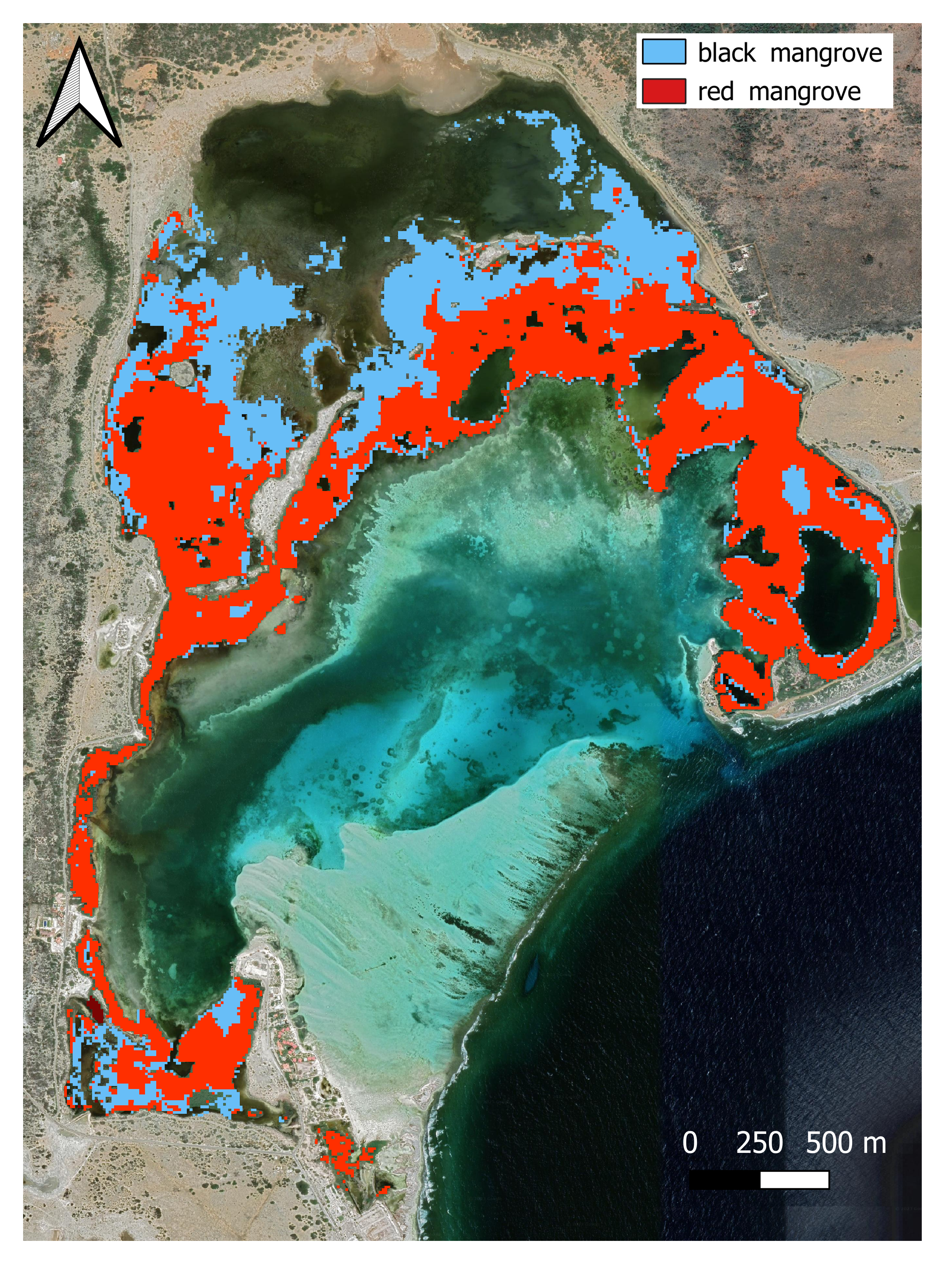
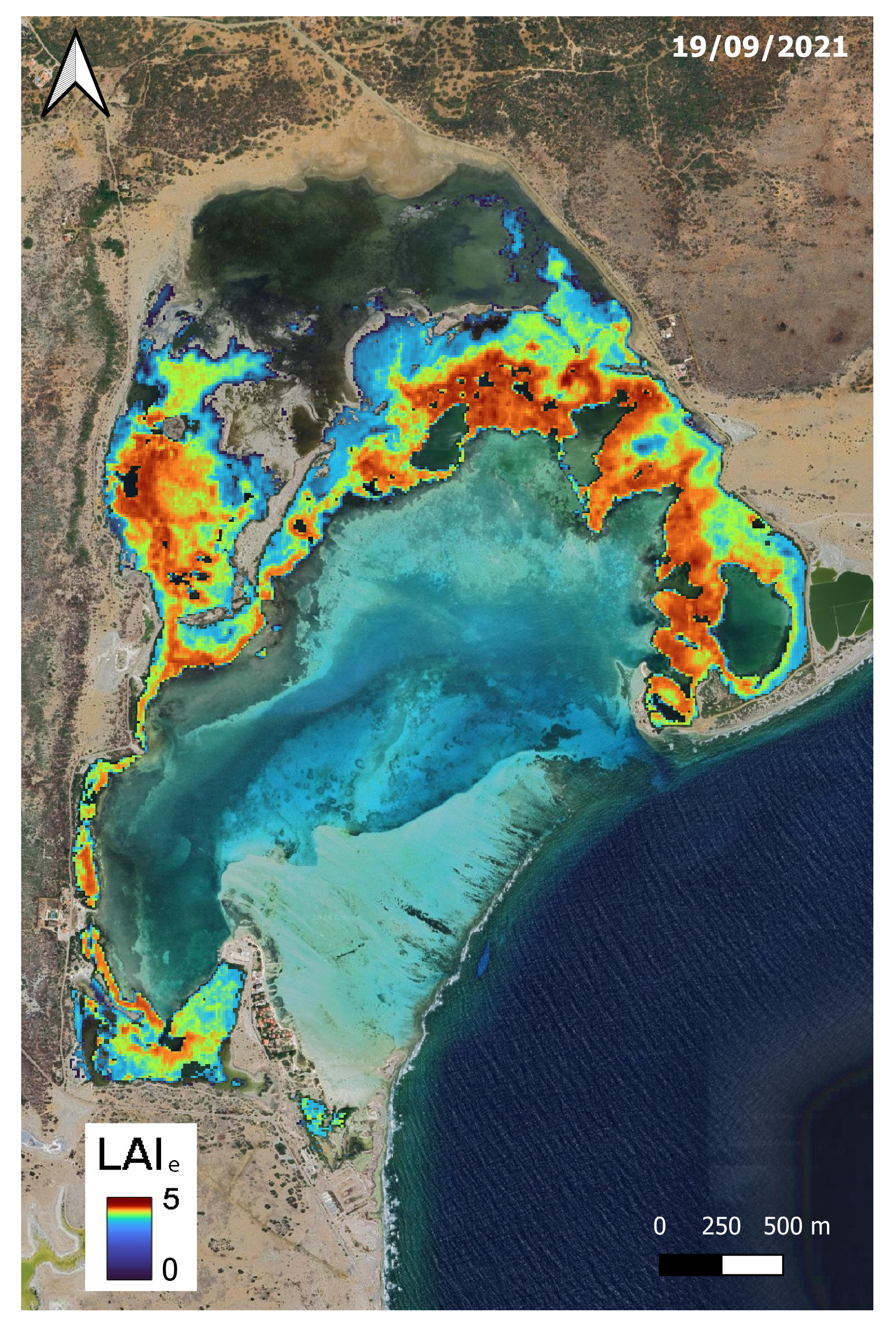
Can small mangrove forests be monitored from space?
The decline of mangrove forests worldwide is concerning because these ecosystems offer crucial benefits for both nature and people. They boost biodiversity, shield coastlines, store carbon, and support local fisheries. In the Caribbean, mangroves have suffered in the past twenty years from coastal development, population growth, and climate change. This


